
IGN • 1
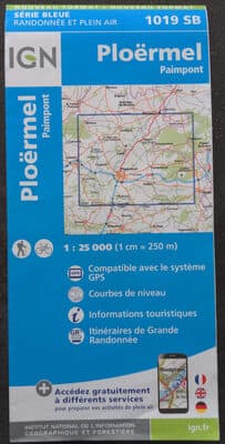
Ploërmel 1019 SB



Product Insights
The Ploer mel 1019 SB is a printed topographic map produced by the French national mapping agency, IGN. It offers detailed official cartographic information for the Ploer mel area, including contour lines, roads and trails, making it valuable for hikers, planners and local authorities. As a paper product, it can be vulnerable to moisture, tearing and wear, so protective storage is recommended for field use.
Comparative Analysis
Unlike generic tourist brochures, the IGN Ploer mel 1019 SB delivers precise, officially validated cartographic data at a detailed scale, positioning it as a premium tool for professionals and serious outdoors enthusiasts.
Unlock Full Product Insights
Scan this and millions of other daily products to reveal hidden ingredients, safety alerts, and comprehensive analysis with the free NutrScan app.
Frequently Asked Questions
Everything you need to know about Ploërmel 1019 SB.